From Maps to Satellite Images: Creating a Visual History with OldMaps
Artem Kostiuk
OldMaps21.10.2025, 16:30
online / Zoom
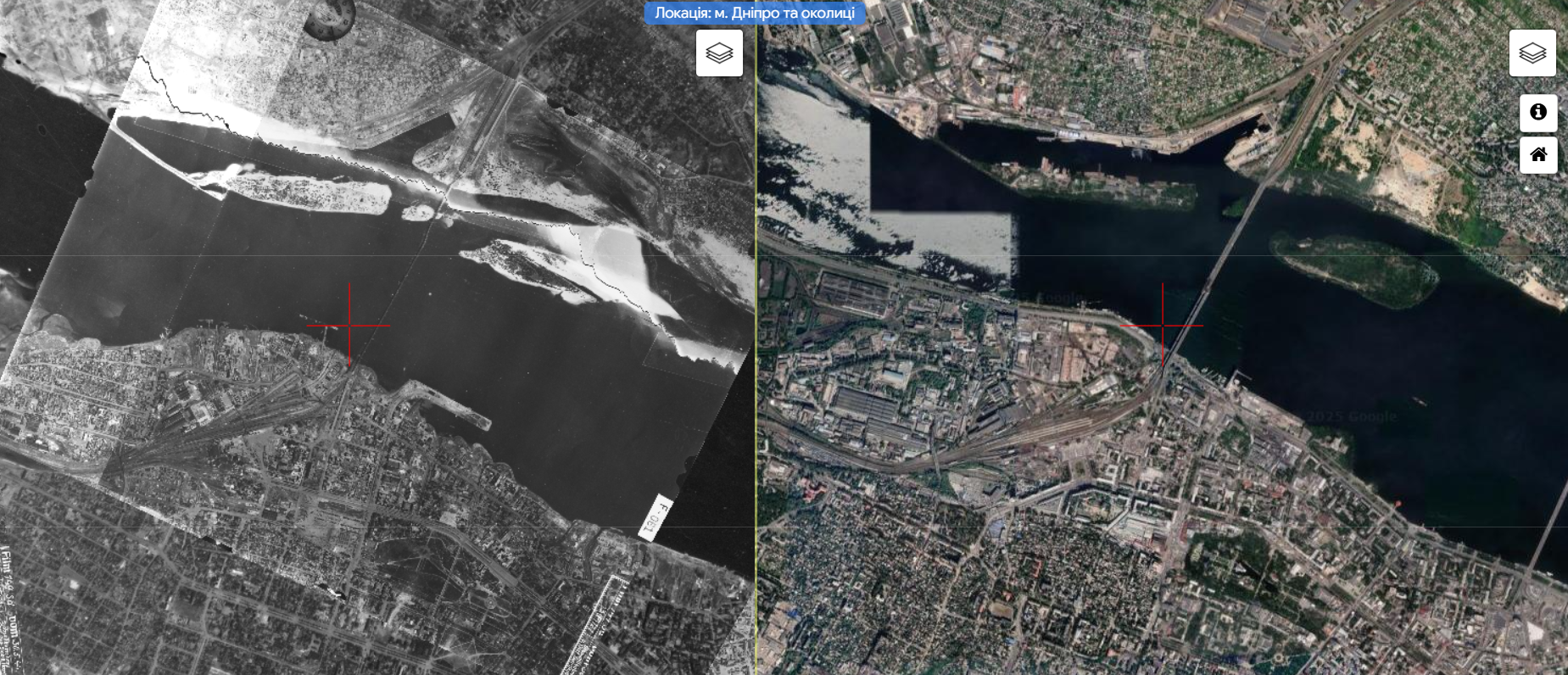
The OldMaps project allows you to see the dynamics of changes in terrain and urban landscapes and discover visual history in a new format. The project's website contains historical maps, aerial photographs, and satellite images combined with modern tools, which allows you to trace how settlements, streets, neighborhoods, and entire districts have changed over time for more than forty Ukrainian cities.
During the presentation, the author of the project, Artem Kostiuk, will talk about the first attempts to create interactive maps, the development process, and sources of materials, show some interesting locations, and share plans for the project's development.
The event will be launched online. To receive an invitation to participate in events, please contact Sofia Andrusyshyn via email: s.andrusyshyn@lvivcenter.org.ua. The presentation will be in Ukrainian with simultaneous translation into English.

Artem Kostiuk
Researcher in the field of historical cartography, founder of the OldMaps project. He specializes in the analysis and digitalization of historical maps and archival aerial photographs. He is a historical blogger, journalist, and researcher of the history of the city of Dnipro.
The event will take place within a series of seminars and workshops around specific cases of urban history digital platforms/projects, "Urban History Digital Infrastructures: Sharing Expertise and Networking Cities", organized by Center for Urban History, with the support of the Center for Governance and Culture in Europe at the University of St.Gallen.