Mapping the Austro-Hungarian Monarchy 1817 – 1861. Lviv and the Cadastre of Francis I
Susanne Fuhrmann
Federal Office of Metrology and Surveying, ViennaSeptember 16, 2009
Center for Urban History, Lviv
Susanne presented the most ambitious cartographic projects of the 19th century in Central Europe and its values for historians.
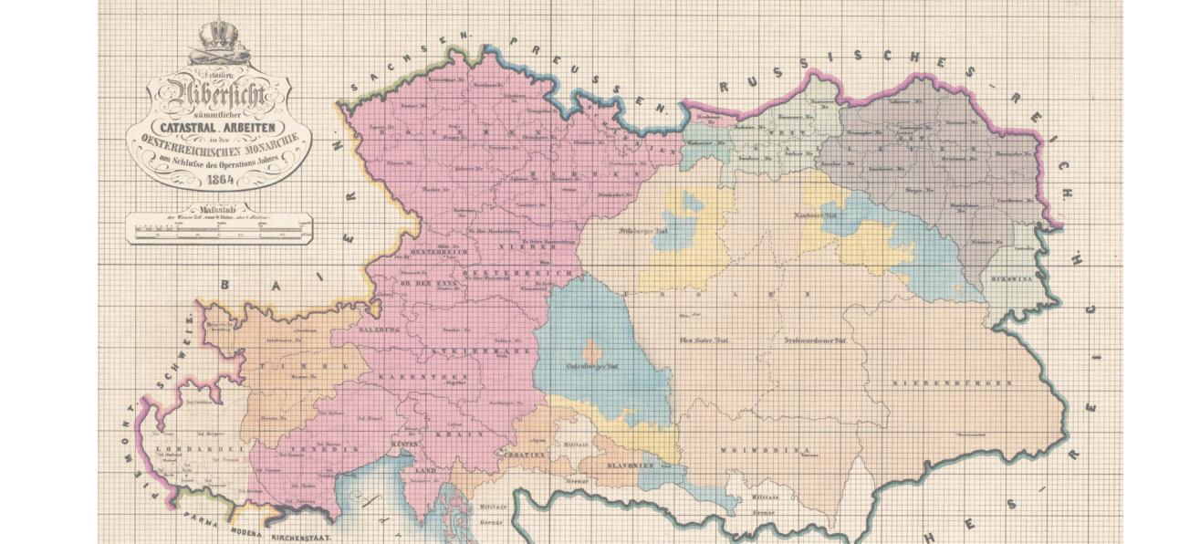
On the 23rd of December 1817, Emperor Francis I. ordered the general economic survey of all pieces of land in the provinces of the Austro-Hungarian Monarchy. The immense project required a detailed measurement of 670 000 km² of land and finally resulted in the production of about 330 000 map sheets. The Cadastral Survey was started in 1817 in Lower Austria and the Coastal Areas and came to a conclusion only 44 years later, in 1861, in Tyrol.
The original map sheets are colourized papers in a format of 53 cm x 66 cm. The maps mark all the boundaries of the properties and different land use at a scale of 1: 2880.
Today about 54 000 maps and registers with the names of the owners are archived in Vienna at the Cadastral Archive of the Federal Office of Metrology and Surveying. The State Historical Archive in Lviv should keep about 25 000 cadastral maps which were made between 1824 and 1854.
After the collapse of the Monarchy, the original map sheets were given to the respective countries. Today the pieces of one of the most ambitious cartographic projects of the 19th century are dispersed among nine countries - Austria, Poland, Ukraine, Romania, Czech Republic, Slovakia, Slovenia, Croatia and Italy.
The cadastral maps and the pertaining parcel protocols are of great importance to owners, surveyors, historians and geographers. They describe the history of the ownership, the course of the boundaries between the plots and the land usage of all parcels in the scales 1: 2880, 1: 1440 or 1: 5760.
It is only in the last years that the public and the scientific community have become increasingly aware of the great value of this source.